Context: MArch (Professional) thesis
Role: Sole author
Tools: Rhino, Grasshopper, Kangaroo 2, Photoshop, Illustrator, InDesign
Year: 2024
Status: Academic project
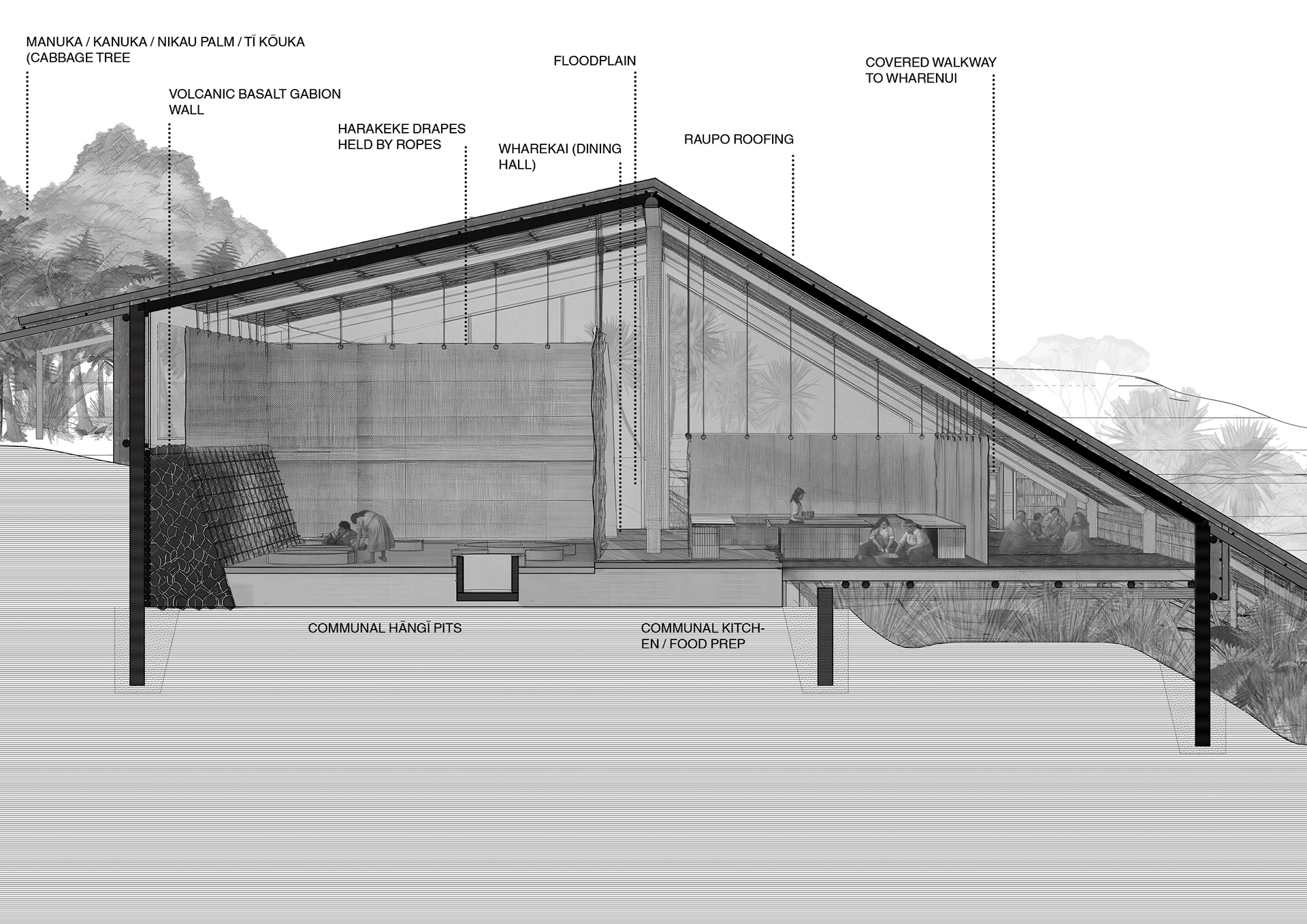
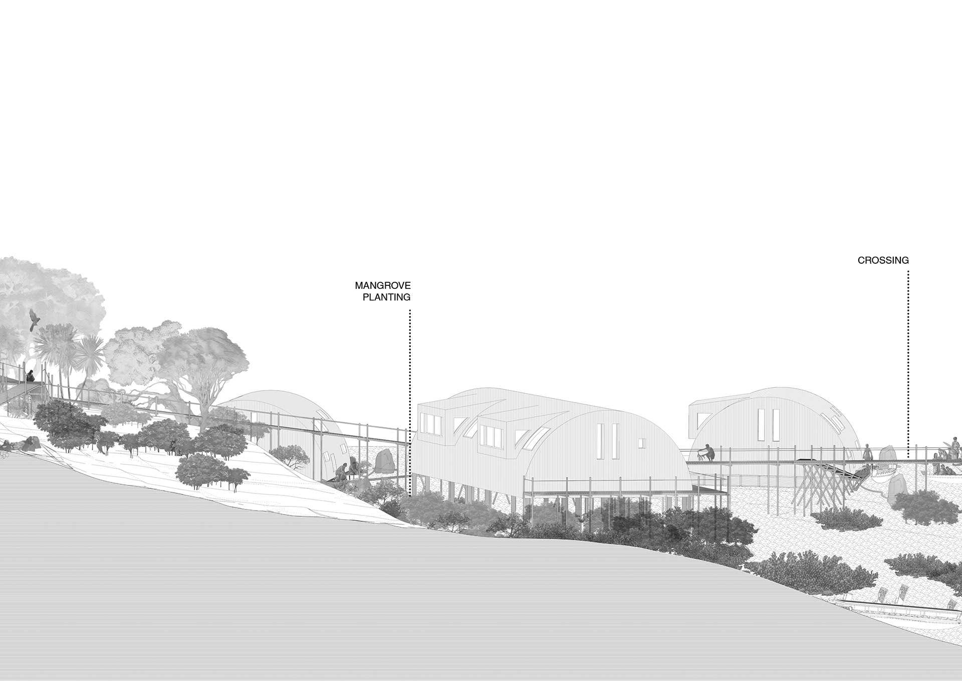
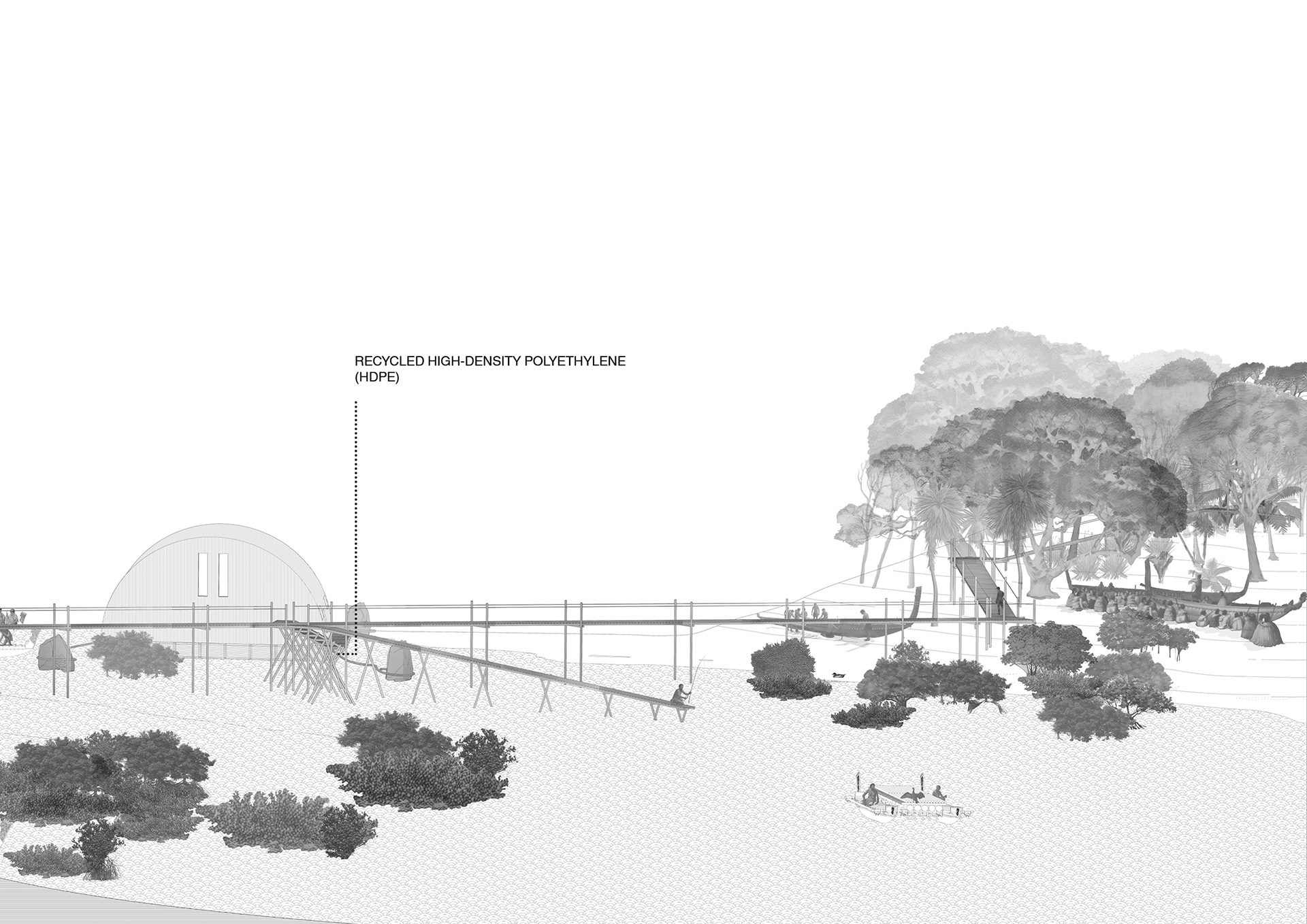
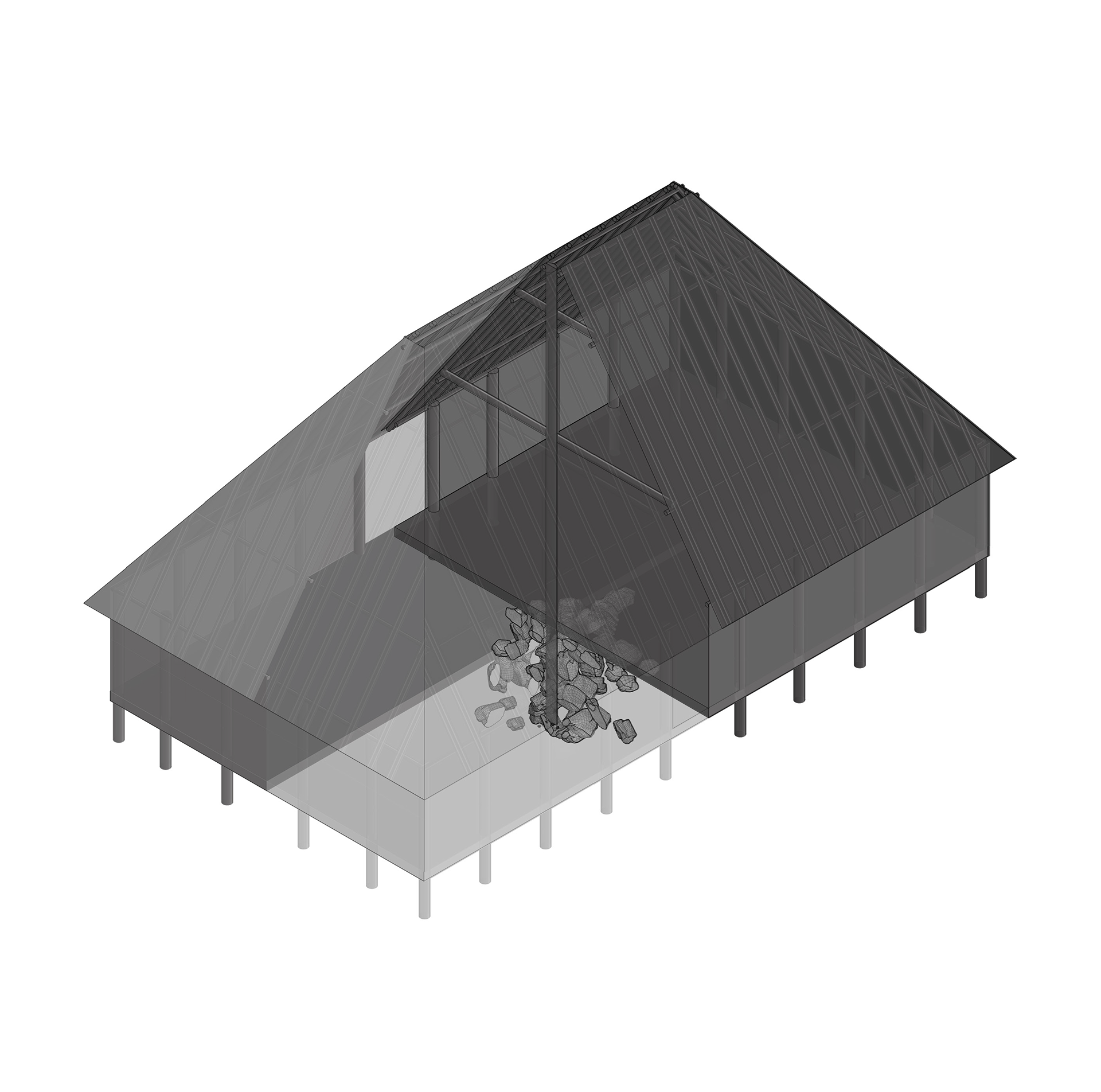
Communal Hāngī Pits and Kīhini (Kitchen) — Perspective Section
This perspective section cuts through the communal hāngī pits and shared kitchen, with the wharekai beyond, gently separated by harakeke drapes. This space is the social and operational heart of the proposed kāinga at Ngāti Whātua Ōrākei’s Pourewa Reserve where cooking, eating, and gathering coexist amongst a floodplain and overland flow path that passes between the Wharekai and Wharenui, while a single continuous roof unifies both spaces.
Contextual Vernacular Architecture as Natural Hazard Mitigation and Adaptation is a Master of Architecture (Professional) thesis completed at the University of Auckland.
Responding to the amplification of natural hazards following the Auckland Anniversary Weekend floods and Cyclone Gabrielle in 2023, the thesis investigates the potential of vernacular architecture to address these escalating climate-induced hazards.
It addresses a gap in contemporary scholarship by evaluating vernacular technologies contextually, extrapolating global precedents and traditional Māori responses to natural hazards and synthesising them into a Contextual Vernacular Architecture Framework.
That framework is then projected through a design proposal for a meandering kāinga (traditional unfortified Māori village settlement) at Ngāti Whātua Ōrākei’s Pourewa Reserve, a site constrained with overlapping hazards including coastal erosion and inundation, floodplains, overland flow paths, and unstable soil.
The methodology includes literature review, collage, framework development, and 3D modelling, ensuring a thorough understanding of vernacular applications in contemporary contexts.
The methodology includes literature review, collage, framework development, and 3D modelling, ensuring a thorough understanding of vernacular applications in contemporary contexts.
This research’s contribution lies in merging indigenous knowledge with modern practices and offering a contextual framework for applying vernacular architecture to natural hazard mitigation and adaptation. It emphasises the need for culturally relevant and environmentally harmonious architectural solutions in the face of increasing climate-induced hazards.
Research undertaken with permission from Ngāti Whātua Ōrākei.


Full Perspective Section, 7m at 1:50
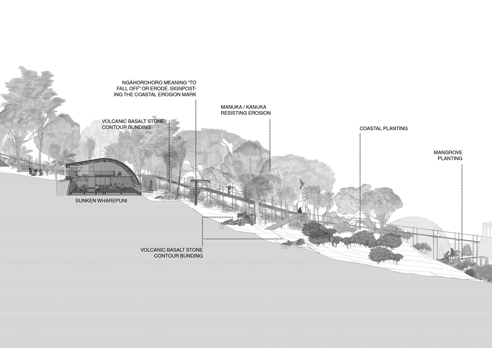
Site Context
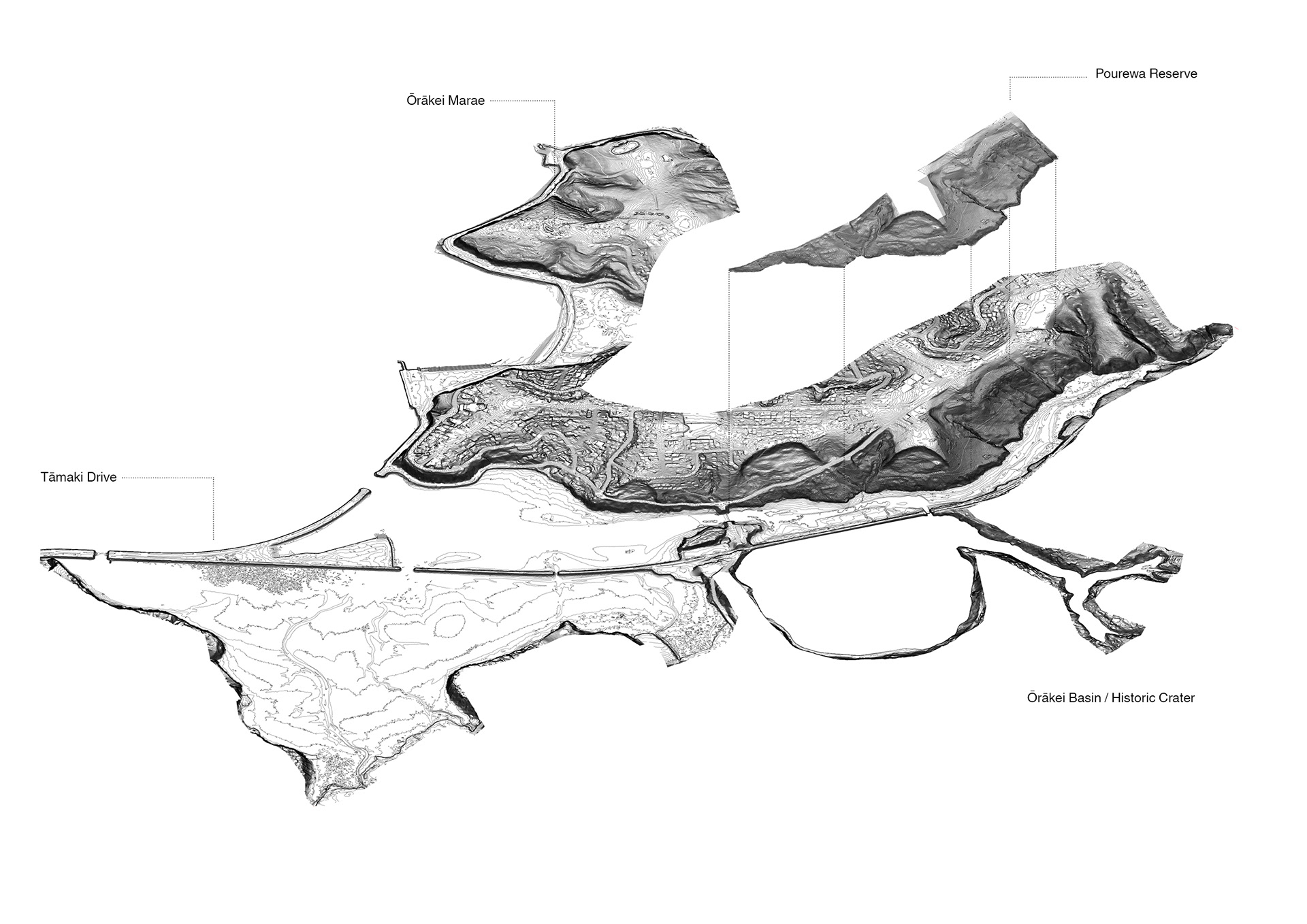
Isometric of Pourewa Reserve
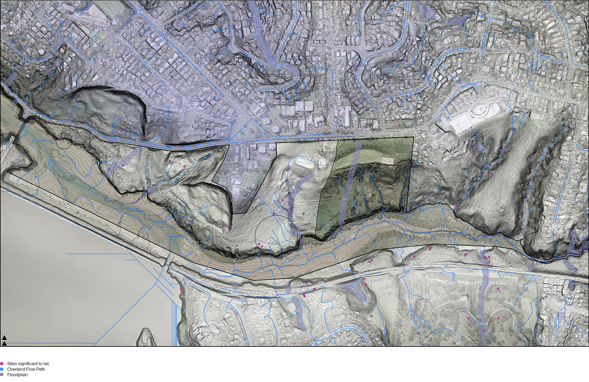
Site Plan
Terracing
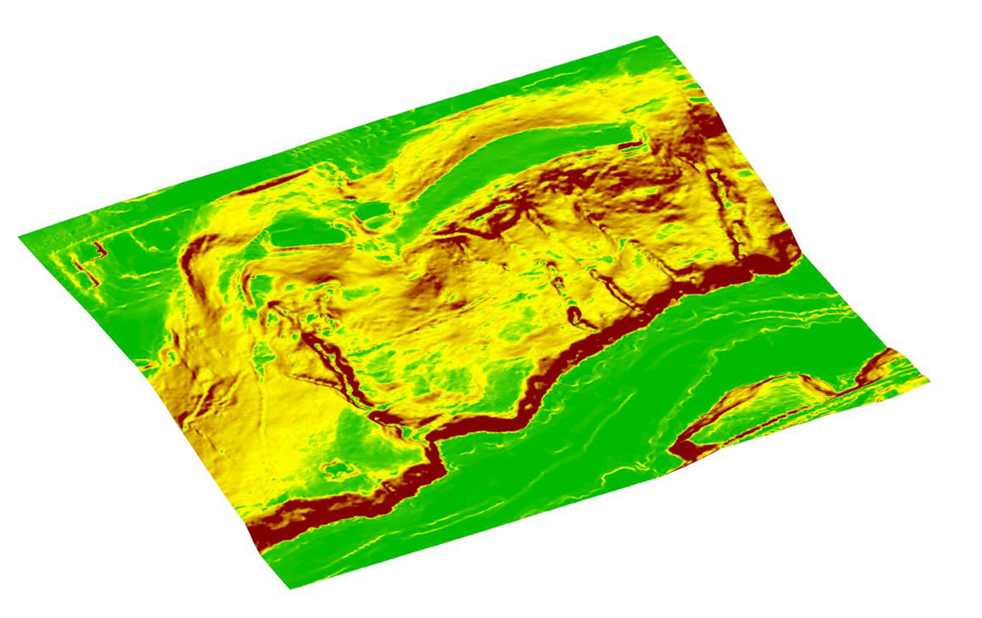
The site was modelled using the Council’s GIS data, from which a plan was drawn. A smaller section of the site was selected for development as it encompassed all the natural hazards present in the larger site and was near established amenities such as the nursery, māra kai, buildings, and utilities. Pourewa Reserve, identified as a site subject to land instability, has gradients indicating potential risk (see image above). Considering the steep gradient and surrounding unstable land (notified by iwi consultation), terracing was strategically employed to avoid disruptions of natural systems and to be economical. This approach involved terracing only the steepest parts of the site, adhering to indigenous Māori practice while stabilising the land.
The site’s contours were analysed using GrassHopper to determine the steepest areas (see above). In traditional hill settlements (kāinga), development typically occurs on the most stable and relatively flatter portions of the terrain, minimizing risks associated with natural hazards such as landslides and cloudbursts. Consequently, most of the buildings in this kāinga are located on the flatter portions of the site (marked in yellow and green).
Appendix
Christchurch City Council, edited by Author. Spencer Park Wetland Walk Christchurch. Edited Photograph.

By Author. Reed Dwellings on Spencer Park Wetland Walk. Collage.
Inspired by site-specific artist Mary Miss. Investigating harmony of vernacular techniques with their surrounds, the black and white image masks what could be an unharmonious pairing of different environments' vernaculars, testing Bernard Rudofsky’s techniques in his ‘Architecture Without Architects’ exhibit, and its tendency to present vernacular building as context-free. Also investigating the potential uses and development on space otherwise deemed 'inhabitable'.
Original image from unknown source, edited by Author. A Flooded Auckland Domain after the 2023 Auckland Anniversary Weekend floods. Edited Photograph.
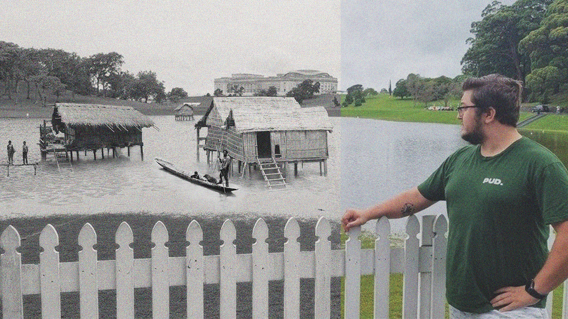
Pukekawa, a historic crater lake and wetland, used by Tangata Māori as a habitat before it was drained by colonial settlers.
Collage. Juxtaposing stilt houses from Bangladesh with the outcomes of the 2023 Auckland Anniversary Weekend floods. Exploring potential adaptation to climate change in the Tāmaki Makaurau context.
Early exploratory collages.
Model of a centrally posted Fijian Bure at Navala.
Traditional Fijian Navala houses provide an exemplary model of cyclone-resilient architecture. Elkharboutly and Wilkinson (2022) highlighted that these houses, known as ‘Bure’, feature hipped roofs and minimal overhangs, which help withstand high wind pressures better than gabled roofs. Their research found that during cyclones, traditional Bure performed better than contemporary-built houses, largely due to their design and materials.
The Navala houses are built with a low centre of gravity, short walls, made of woven split-bamboo or bamboo reeds. Roofing constructed of misimisi grass or reed thatching. Elkharboutly and Wilkinson (2022) mention the Navala community reported that Bure swayed during strong winds, providing time for occupants to seek shelter, whereas modern houses in the area, were rigid and more prone to sudden failure, as well as producing dangerous flying debris, such as steel sheeting from the roof. Both large and small models of Navala houses have hipped roofs with slopes of 55° and 60° respectively. Although studies suggest that a 30° slope is optimal for wind resistance, the observed performance in Navala indicates that the 55° slope is effective in reducing damage. The roof structure is constructed using bamboo cane or straight branches, with structural connections lashed using natural ropes made from flattened bamboo reeds. This method of lashing provides flexibility and strength, allowing the roofs to withstand high wind pressures.
Elkharboutly and Wilkinson (2022) also noted the elevated continuous stone foundations of the Navala houses. These foundations prevent wind from passing under the house floor, reducing the risk of uplift and overturning.
The shape and orientation of buildings are critical for their resilience. Rectangular plans oriented with their short side facing prevailing winds experience less damage during cyclonic events. This design minimises the surface area exposed to the wind, reducing the likelihood of structural failure.
The traditional Fijian Navala houses, with their hipped roofs, bamboo reed walls, and stone foundations, demonstrate effective strategies for withstanding high wind pressures. Integrating windbreaks and optimising building shapes and orientations further enhances the ability to withstand cyclonic events, ensuring safer and more sustainable communities.